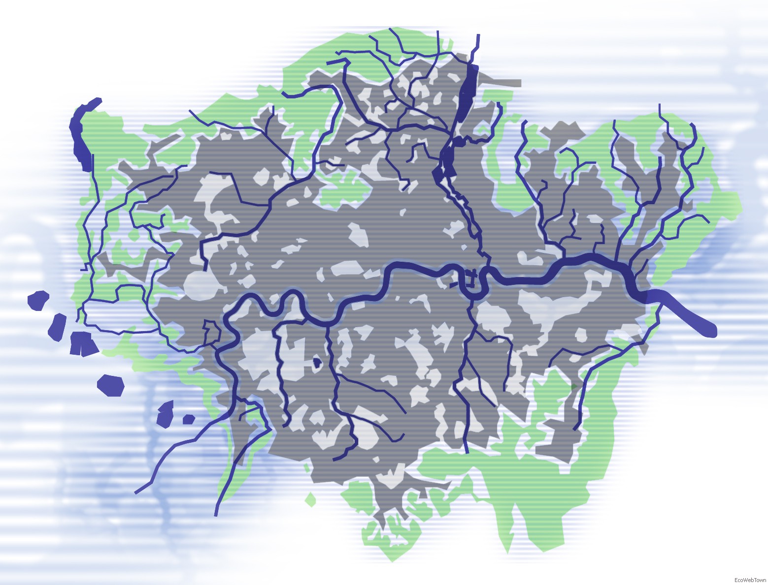
Great London Sustainable Water Network, by Cesare Corfone |
THE BLUE RIBBON NETWORK
The visionary idea of the local administration to make London the sustainability capital of the world has been expressed since 2004 with the London Plan, a city strategy composed of seven primary policies: four theme based and three transversal. Blue Ribbon Network (BRN) is the name given to the strategic plan granted by the basin and the ideographic grid of the Thames, for its resemblance to a network of blue ribbons crossing the land: the strategy of sustainable development linked to the BRN is one of three transversal policies covered in the London Plan. The other two are: zoning and planning strategies, in order to make London a compact city, and strategies for the improvement of urban metabolism and adaptation to climate change. The Blue Ribbon Network is a complex river system which consists of canals, tributaries, reservoirs for drinking water, ports, docks, lakes, tributaries, streams, rivers, even if channeled, covered or deviated. This minor network of water was until recently considered to be a load bearing structure, morphologic and functional for the sustainable urban development of the metropolitan system. The opportunity offered by the BRN is to create a network of urban water spaces that can offer a sequence of active and attractive sites, public spaces which are useful environmentally and socially.
WATER ECOLOGY
In recent decades, while the city of London, recovered and restructured the banks of the Thames through the initiatives called Thames Paths, the transformations in the larger metropolitan area damaged smaller surface water bodies, to the point of leaving large and small tributaries to vanish within the city's sewer system (Fleet River, Tyburn River ed Effra River). The environmental regeneration of the water networks, such as the one envisioned for the Bow Back River System will ensure good water quality chemically and physically, as has been clearly requested in the European Directive on water, and restoring the great potential of these scenic waterways. A major objective of the BRN-related policies is to protect, emphasize and enhance the ecological functioning, the biodiversity and the city landscape of London: re-naturalization of riverbeds and recovery of polluted canals is scheduled, protecting riverbanks from proposed development that may affect existing landscape and ecological values .
WATER SOCIETY
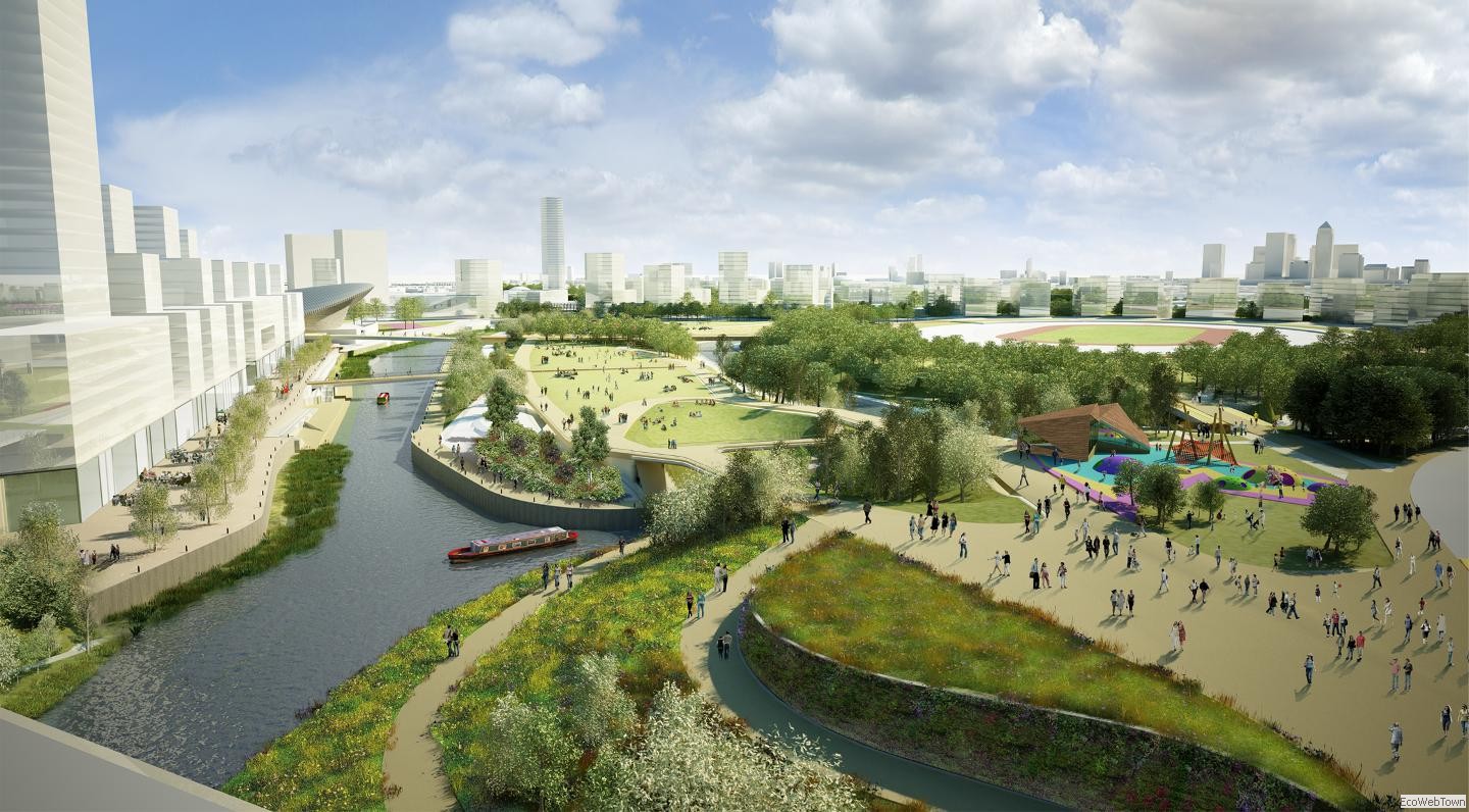
Through recreational activities related to water networks, allowing a large number of citizens to live, work and play safely on the water is a strategic aim of the London Plan: urban water networks can no longer be designed ignoring the public city and then used as a private resource. The increase in value of the river legacy passes through Social Inclusion: the London waterways will be accessible to the entire population, also offering a support for a renewed system for mass transport. The policies include strengthening of the London hydrographic network with the creation of new channels and basins also in order to achieve greater internal network navigability. Great historical, social and cultural sensitivity is placed in the management of the residual Docks of London: it tends to promote their environmental and functional restoration encouraging their use for sports, leisure and tourism through new docking for small pleasure craft. Connections and cycling routes equestrian and pedestrian paths utilizing the water to guide them through the city.
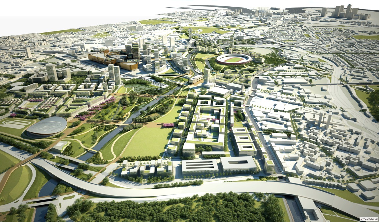
WATER OLYMPICS
Mayor Boris Johnson is offering an interesting continuity to the work begun by the London Plan by Ken Livingstone for the sustainable recovery of the hydrographic network of the River Thames. Its update, the London Plan, published in October 2009, provides wisely that strategies to enhance urban water-related objectives be integrated into a more holistic appreciation of their ecological urban function.
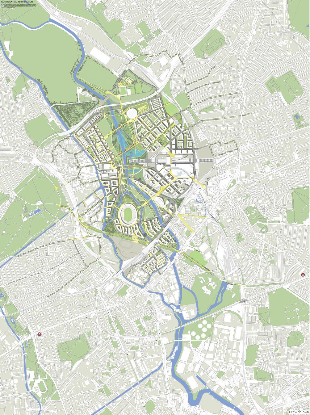
The interrelationship between the strategic Open Space Network and the Green Belt in London will enhance the blue network. A concrete demonstration of the political project of the BRN is easily traced in the designs for the Olympic Park in London. The changes related to the Games affect huge areas where water-related networks: the Bow Back River, the Old River Lea, the City Mill River, and the Channelsea River, serve as a morphogenetic background for the active design of the Olympic areas.
REFERENCES
The London Plan, Spatial Development Strategy for Greater London, Consolidated with Alterations since 2004, Greater London Authority, February 2008.
The London Plan, Spatial Development Strategy for Greater London, Consultation draft replacement plan, Greater London Authority, October 2009.
Olympic Delivery Authority, Planning Decisions Team, Olympic Park area in East London and Development Control Manual, September 2009.
Lea Valley Regeneration Design Team, Preferred Olympic Park Masterplan, Stratford City Development LTD, Febraury 2009.
Trevor Timpson, Waterways face new Olympian task, BBC Archive, April 2008.
IMAGES
Legacy Masterplan Framework London, Structural development of London Olympic Park after the Games of 2012, KCAPArchitects&Planners, www.kcap.eu
CREDITS
London Sustainable Water Network graphic design: Alessandra Antonetti.